|
|||||||||||


|
|
||||
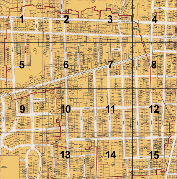
Old West Side: Online Map
The Old West Side is defined by the red boundary line. |
|
City of Ann Arbor, Michigan |
Michigan State Plane Coordinate System, South Zone |
|
Topography, planimetric features, and digital orthophoto images based on 1993 and 1997 aerial photography. Copyright 2001 City of Ann Arbor, Michigan No part of this product shall be reproduced or transmitted in any form or by any means, electronic or mechanical, for any purpose, without prior written permissions from the City of Ann Arbor. This map complies with National Map Accuracy Standards for mapping at 1 inch = 100 feet. The City of Ann Arbor and its mapping contractors assume no legal responsibility for the content and/or inappropriate use of information represented on this map. |
|
![]() home / contact us / become a member
home / contact us / become a member
homes tour / neighborhood association / map / building code / news and events / newsletter / links